Satellite Data | SAR & VHR
SAR, optical, and hyperspectral data for the world’s most critical energy, agriculture, and maritime assets.
In addition to its proprietary GESat hyperspectral constellation, Sensing leverages its distribution agreements with the world’s leading SAR and VHR optical constellations to offer through its PLUM platform the most state-of-the-art satellite data products.
PLUM is our digital marketplace which, combining the power of artificial intelligence with our bare-metal infrastructure, enables easy visualization and purchase of Sensing’s own satellites datas as well as our partners’ constellations.
Expertises
Access SAR and VHR Satellite Partner data
SAR Data
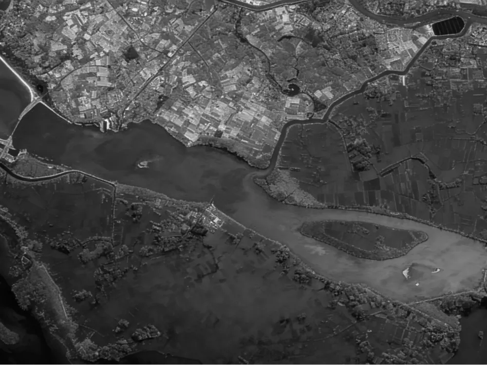
Synthetic Aperture Radar (SAR) is the only technology capable of collecting images day and night under any weather conditions, with X-band able to penetrate through clouds, smog, volcanic ash, and sandstorms.

VHR Optical Data
Very High Resolution (VHR) Optical data enables a wide range of applications and the generation of analytics for automatic detection and object identification, with high geolocation accuracy and world-class data quality.
use cases
SAR Data
Monitoring, anticipating and securing critical energy infrastructure
In the remote, often inaccessible expanses of oil fields, pipelines, and offshore platforms, satellite SAR data delivers continuous, all-weather visibility where ground crews fall short.
From spoting subtle pipeline deformations to estimating oil volumes inside storage tanks, energy traders gain weekly, independent inventory intelligence for smarter trading decisions, while operators and insurers detect early leaks, subsidence risks, and asset integrity issues before they escalate into costly disasters.
From offshore rig monitoring to rapid post-storm damage assessment, SAR turns invisible threats into actionable foresight.
Ultimately, it transforms energy and power operations from reactive guesswork into proactive, data-driven mastery—safeguarding assets, supply chains, and bottom lines across the sector.
Monitoring the oceans continuously, regardless of the conditions
In the vast, unpredictable oceans where visibility is often zero, satellite SAR data pierces through clouds, fog, and total darkness to deliver unmatched 24/7 maritime surveillance. This all-weather edge enables instant tracking of illegal fishing fleets, smuggling routes, and unauthorized incursions, turning invisible threats into actionable intelligence.
From rapid oil spill mapping to real-time congestion monitoring at busy harbors, SAR empowers shipping giants, navies, insurers, and environmental agencies with timely, reliable insights that save lives, assets, and ecosystems. Ultimately, it transforms maritime domain awareness from guesswork into a strategic superpower, keeping global trade flowing safely on our blue planet.
Assess claims quickly to act without delay
Satellite SAR data acts as an all-seeing eye that penetrates heavy clouds and darkness to deliver critical insights when disasters strike, while enabling insurers and energy operators to safeguard billions in assets against natural catastrophes. Emergency responders gain immediate access to precise damage assessments and inundation maps exactly when time matters most.
Rescue teams immediately access accurate damage assessments and flood maps when every minute counts. Insurers benefit from faster claims validation and more precise risk models.
Use cases
VHR Data
Commodity Trading & Business Intelligence
Unlock a strategic edge by transforming sub-meter satellite imagery into a real-time financial oracle for global markets. From counting vehicles in retail parking lots to monitoring oil storage levels and crop health, VHR optical data reveals economic activity before official reports emerge.
This early visibility empowers traders to anticipate supply shocks and demand shifts with unmatched precision. By grounding investment decisions in visual evidence, firms reduce uncertainty and execute high-confidence trades ahead of the curve. Ultimately, this technology converts raw pixels into actionable insights, securing a decisive competitive advantage in volatile markets.
Insurance Risk Modeling & Claims Validation
Transform your loss ratio with VHR optical data that delivers sub-meter clarity on every insured asset across your portfolio. Pre-event baselining empowers underwriters to price risk accurately by visualizing asset conditions and surrounding hazards before policies are written. When catastrophes strike, instant visual verification accelerates claims settlement by confirming damage remotely without costly site visits.
This operational efficiency drastically reduces adjustment expenses and closes the door on fraudulent claims across large exposure zones. Ultimately, turning high-resolution pixels into actionable proof shifts your strategy from reactive payouts to proactive risk management.
Measure Global Energy Activity
Unlock a strategic edge by transforming sub-meter satellite imagery into a real-time financial oracle for global markets. From counting vehicles in retail parking lots to monitoring oil storage levels and crop health, VHR optical data reveals economic activity before official reports emerge.
This early visibility empowers traders to anticipate supply shocks and demand shifts with unmatched precision. By grounding investment decisions in visual evidence, firms reduce uncertainty and execute high-confidence trades ahead of the curve. Ultimately, this technology converts raw pixels into actionable insights, securing a decisive competitive advantage in volatile markets.