Solutions | Insurance
Predict Catastrophe Before It Strikes: Next-Gen Force Majeure Intelligence.
Sensing combines proprietary hyperspectral and thermal infrared satellite data with AI analytics to deliver predictive risk intelligence for insurers—enabling proactive underwriting, faster claims, and innovative parametric products for wildfire and hurricane exposure.
your challenges
Why Insurers Choose Sensing
-
Rising wildfire losses & uninsurable zonesDetect fuel moisture stress & ignition risk weeks in advance using hyperspectral sensors—enabling proactive risk mitigation
-
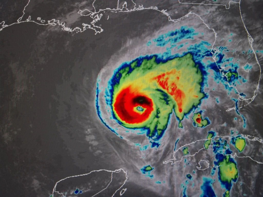
Hurricane loss uncertaintyTrack sea surface temperature anomalies storm intensification signals with thermal infrared for earlier, more accurate impact forecasts
-
Slow claims cycles after catastrophesCombine pre-event risk baselines with post event thermal/optical fusion for automated damage validation within hours—not weeks
-
Parametric product design complexityProvide objective, satellite-verified triggers (e.g., fuel dryness index, thermal anomaly thresholds) with transparent, auditable methodology
-
Climate model uncertaintyGround-truth catastrophe models with observed satellite data, reducing basis risk and improving pricing accuracy
technology edge
Our Technology Edge:
Beyond Reactive Monitoring
GESat Data: See Risk Before It Ignites
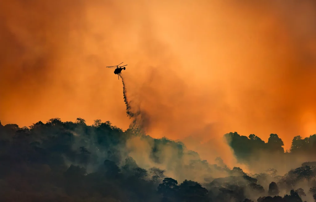
All-weather hyperspectral-based solutions for wildfires events
- Predict: vegetation stress detection to identify drought-stressed canopy & invasive species patterns that elevate fire spread risk, and fuel moisture content variations at <30m resolution— both critical for wildfire ignition probability modeling
- Monitor Event: Short-wave infrared (SWIR) bands penetrate smoke and haze for continuous monitoring during active events
- Assess post-fire recovery analytics: Assess burn severity and regeneration trajectories to refine long-term risk models
Force majeure event solutions
- Hurricane intensity forecasting: monitor sea surface temperature gradients and cloud-top cooling rates to improve storm track and intensity predictions
- Infrastructure thermal profiling: Detect overheating transformers, substations, or industrial assets vulnerable to cascade failure during extreme events
- Nighttime operations: Thermal sensing operates 24/7, providing continuity when optical systems are limited
Multi-Source Predictive Analytics Engine
We fuse proprietary sensor data with complementary sources to deliver forward-looking intelligence.
GESat hyperspectral & thermal infrared
Active fire detection, storm thermodynamics, infrastructure stress, fuel conditions, vegetation health, soil moisture proxies.
Satellite Partner Optical & Synthetic Aperture Rada
Asset-level exposure mapping, all weather change detection, near-real time events monitoring, flood extent validation.
Weather & climate models
ECMWF, NOAA feeds for dynamic risk scoring.
Claims & exposure data
Client-provided portfolio data for customized risk attribution.
intelligence pipeline
AI-Powered Risk Intelligence Pipeline
Our automated workflow transforms raw satellite data into insurer-ready insights:
Predictive risk score
Asset-level wildfire/hurricane vulnerability indices updated weekly
Early warning alerts
Automated notifications when risk thresholds are breached
Event impact forecasts
Probabilistic loss estimates delivered 24 hours before landfall / fire spread
Parametric trigger verification
Objective, satellite-validated data for automated payout execution
our solutions
Solutions by Insurance Function
Underwriting & Portfolio Management
Price risk accurately, avoid adverse selection, expand into new markets
- Dynamic risk scoring for individual properties using fuel moisture, topography, and infrastructure proximity
- Regional exposure heatmaps updated weekly to support territory planning and reinsurance buying
- Climate resilience scoring to identify assets benefiting from mitigation investments
Outcome:
More accurate premium pricing, reduced accumulation risk, confident expansion into climate-volatile regions
Claims & Catastrophes Response
Accelerate settlements, reduce loss adjustment expenses, improve customer experience
- Pre-event baseline imagery for rapid "before/after" damage validation
- Automated building-level damage detection using thermal + optical fusion (no field inspection required)
- Prioritized triage lists identifying highest-severity losses for rapid deployment
Outcome:
40–60% faster FNOL processing, reduced claims leakage, higher policyholder satisfaction
Parametric & Index Insurance Innovation
Design transparent, scalable products for emerging climate risks
- Customizable satellite-verified triggers: fuel dryness index, thermal anomaly duration, wind speed proxies
- Basis risk minimization through high-resolution (≤30m) observation data vs. coarse weather station networks
- Automated payout execution via API integration with policy administration systems
Outcome:
New revenue streams, faster time-to-market for climate products, reduced disputes over trigger validation
Reinsurance & Capital Markets
Improve cat bond structuring, ILS pricing, and portfolio risk transfer
- Observed loss data to validate and refine catastrophe models (reducing model uncertainty)
- Real-time event monitoring for accurate loss development forecasting
- Transparent, auditable data trails for regulatory reporting and investor confidence
Outcome:
More efficient capital allocation, stronger investor trust, competitive advantage in ILS markets
How It Works
From Prediction to Payout
Diagnostic
Meet with one of our experts, explain your needs, and we will formulate a solution.
No upfront paymentExecution
Whether on a fixed-price basis or with on-site technical assistance, a dedicated Sensing Architect works on your use case, leveraging our proprietary and partner data streams processed in sovereign EU facilities.
EU sovereign processingDelivery
Tailored to meet your needs, from the delivery of customized reports to the integration of APIs directly into your decision-making systems.
API · Encrypted · Air-gappedTrusted By
resources